

Government
Government programs we assemble and run for the long term
We assemble each program on M4, our multi-tenant platform, and run it for the long term, with strategic advice, development, cloud operations and continuous improvement from one team. Our longest Government programs have been with us for more than a decade.
What M4 brings to Government programs
SharkSmart shows how the tiers fit together. It uses M4’s core as it is, extends it where the program needs to work differently, and adds modules crafted only for it.
Core · configured
Shared features every program uses as they are. We run them, secure them and keep them current for everyone.
Extended capability · extended
A core feature we extend for your program, with your own fields, rules and behaviour, without changing it for anyone else.
- Alerts
Publish alerts to the people who need them, carrying the detail your program depends on.
Custom modules · crafted
Modules we craft only for your program and plug into the core, so they use features like sign-in, media, notifications and data.
- Beach-safety operations
The operator tools behind a statewide shark-safety program.
Field Mobility
Tools for staff working in remote, distributed or regulated environments
Mobiddiction delivers field mobility tools that combine real-time positioning, offline capability, spatial overlays and tight integration with enterprise systems.
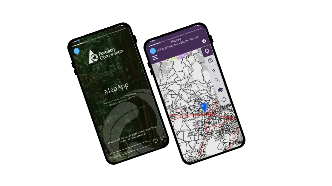
For Forestry Corporation of NSW we develop MapApp, the field platform used across the organisation. It works with the corporation’s ESRI ArcGIS services and high-accuracy GNSS receivers, and its dynamic boundary warning system alerts operators as they approach or cross harvesting boundaries, allowing for machinery with a reach of up to 10 metres. It is central to meeting the conditions of Forestry’s environmental licences.
Around 90% of MapApp use is in remote locations without internet access, so crews download the day’s maps and plans before they leave, work offline, and sync captured data and GNSS tracks when a connection returns.

Foundational spatial infrastructure for NSW surveyors
NSW Spatial Services engaged Mobiddiction to take SCIMS Online, the state’s source of truth for control survey data, into the field. Survey Mark lets surveyors find survey marks on NSW base maps and imagery, view published coordinates and sketch plans, and report each mark’s condition. We ran the requirements review, design, development, testing and release on ArcGIS and the ESRI JavaScript API, developed a framework for Spatial Services’ future mobile work, and have since added GDA2020 coordinates.
A statewide public safety program that now runs on M4
SharkSmart is the NSW Government’s platform for shark detections, beach alerts and cross-agency coordination, operated by the Department of Primary Industries and Regional Development (DPIRD). Mobiddiction has delivered and operated it since 2014, leading architectural assessment, data integration planning, system design and service management. It brings together acoustic listening station detections, drone surveillance and field reports for the public and for partners such as Surf Life Saving NSW. Originally delivered on Mobiconnect and since modernised onto M4, it runs on separately provisioned infrastructure for compliance, on the same M4 codebase, released on its own schedule.

Legislated fishing rules, mapped to about a metre
FishSmart gives recreational fishers the rules for where they are: bag and size limits and legislated fishing zones across NSW waters. NSW DPIRD Fisheries staff maintain zone boundaries and regulations in Mapbox Studio as the single source of truth, and changes reach users through API integration, with offline maps for areas without coverage. Mobiddiction delivers the technical development, hosting and operational support, and the app has passed 350,000 downloads since 2015.
More than a decade of Government programs
Each of these programs began as a project and became a long-term partnership.
Wild About Whales
Our first government program: a whale watching app for the NSW National Parks and Wildlife Service, combining mobile, citizen science, mapping and wildlife data. It ran until 2021, and its successor, WhaleWatch, is our own community app.
SharkSmart
Work begins on the NSW SharkSmart program for shark detections, beach alerts and cross-agency coordination. It continues today.
FishSmart
The official NSW recreational fishing app launches, with location-specific rules and legislated fishing zones. It is still active, with over 350,000 app downloads since 2015.
Survey Mark and Forestry Corporation of NSW
Survey Mark launches for NSW Spatial Services, and our mapping, RTK GNSS and field mobility work with Forestry Corporation of NSW begins. Both continue today.
Drought and Supplementary Feed Calculator
A web and mobile tool for the NSW Department of Primary Industries that helps sheep and cattle producers plan feed rations before, during and after drought.
Mobiconnect becomes M4
M4, our multi-tenant platform, is the managed core that PatientVR, Mapiddiction, SharkSmart and Mobiddiction’s own website and support portal run on today.

Decision Support
Technical design and advice for producers in drought
For the NSW Department of Primary Industries we turned decades of livestock nutrition research, supplied as a multi-tab spreadsheet with undocumented formulas, into the Drought and Supplementary Feed Calculator: a web app with native iOS and Android versions for use in the field.
We worked through the data requirements, workflows and calculations with livestock specialists, then recreated every calculation and checked its outputs against the original. The tool helps sheep and cattle producers plan feed rations before, during and after drought.
Emerging Technologies
Drone capture for precise, current mapping
Satellite imagery can be years out of date for sites that change constantly. Our drone and photography teams capture current aerial imagery and turn it into accurate custom maps for planning, operations and wayfinding.
For InvoCare we mapped memorial parks across NSW and Queensland. Each aerial photograph carries its own geodata, so later changes need only a localised drone mission rather than a full re-fly.
AI that improves development, operations and service quality
Engineering automation
Our engineering teams use intelligent automation for code reviews, regression checks and documentation.
Operations and monitoring
Operations teams use AI-supported analysis to triage incidents, monitor usage patterns and assess system performance.
Spatial and data-heavy programs
We use AI to extract insights, validate geospatial layers and support visualisation.
Cyber defence
AI-assisted log analysis, anomaly identification and event correlation.
Support content
AI drafts customer support material and knowledge base articles, which experienced staff then review.
Strategic advice, stable delivery and accountable governance
Strategic advisory
Architectural reviews, technology assessments, program analysis and forward planning that guide multi-year government initiatives.
Programs that endure
Our longest government programs have run with us for more than a decade, supported by stable managed services.
Certified information security
Our Information Security Management System is certified to ISO/IEC 27001:2022, so governance, security and documentation requirements are managed and auditable.
Multidisciplinary teams
Engineers, spatial specialists, security practitioners, DevOps teams and project managers working together with clear accountability.
One managed platform
M4, our multi-tenant platform, gives each program a managed core we run once, extended where your program needs it to work differently, with custom modules for what is yours alone.
Modern capability
Spatial, AI, cloud and mobile capability that helps agencies modernise their systems safely.
Our controls and policies, ready to review
Procurement and security teams can review our ISMS certification, controls and policies in our Trust Centre.
Tell us what your program needs
We’ll show you what M4 already covers, what we’d extend and what we’d craft for you. We love tech, but speak human.