

FishSmart
The right fishing rules, right where you are
FishSmart is the official recreational fishing app of the NSW Department of Primary Industries and Regional Development (DPIRD). We have delivered and run it with DPIRD Fisheries since 2015.
- Run with NSW DPIRD Fisheries
- Since 2015
- App downloads
- 350,000+
- Rules and zones without mobile coverage
- Offline
Why It Exists
Printed guides could not keep up with the water
Coastal waters, inland rivers and offshore zones each have different rules for different species. Fishers relied on printed guides that went out of date and could not show which rules applied where they were standing.
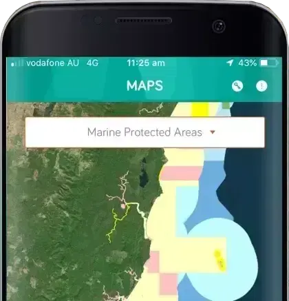
FishSmart finds where you are and shows the rules for that spot: permitted species, bag and size limits and gear rules, with marine park zones, closures, fish aggregating devices and artificial reefs drawn on the map.
Zone boundaries that match the law
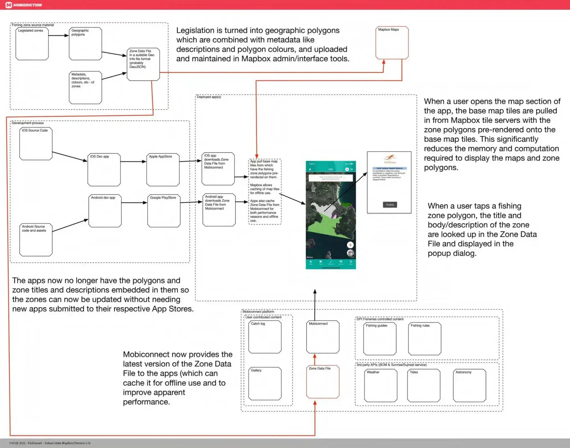
Fishing zones come straight from the department’s own mapping, the single source of truth for legislated boundaries, accurate to about a metre across NSW waters, including around Lord Howe Island. Maps and rules are stored on the phone, so they work where there is no coverage.
A private catch log, shared only by choice
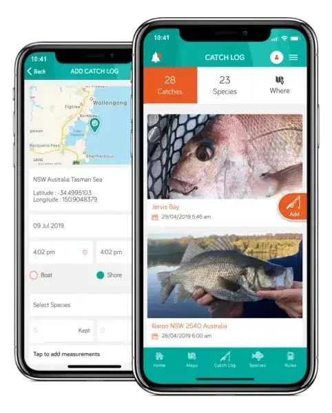
Fishers can log a catch with a photo, species and location, keep it private, or choose to share it with DPIRD for fisheries research.

News and rule changes, sent by the department
DPIRD Fisheries staff publish news, videos, seasonal closures and urgent rule changes, and send them as push notifications to fishers who want them.
How It Works
One source of truth, from legislation to the app
Fisheries mapping specialists draw each zone and attach its rules in the department’s own mapping tools. The platform reads that data and turns it into maps and rules the app can show offline, so a boundary change reaches fishers without anyone entering it twice.
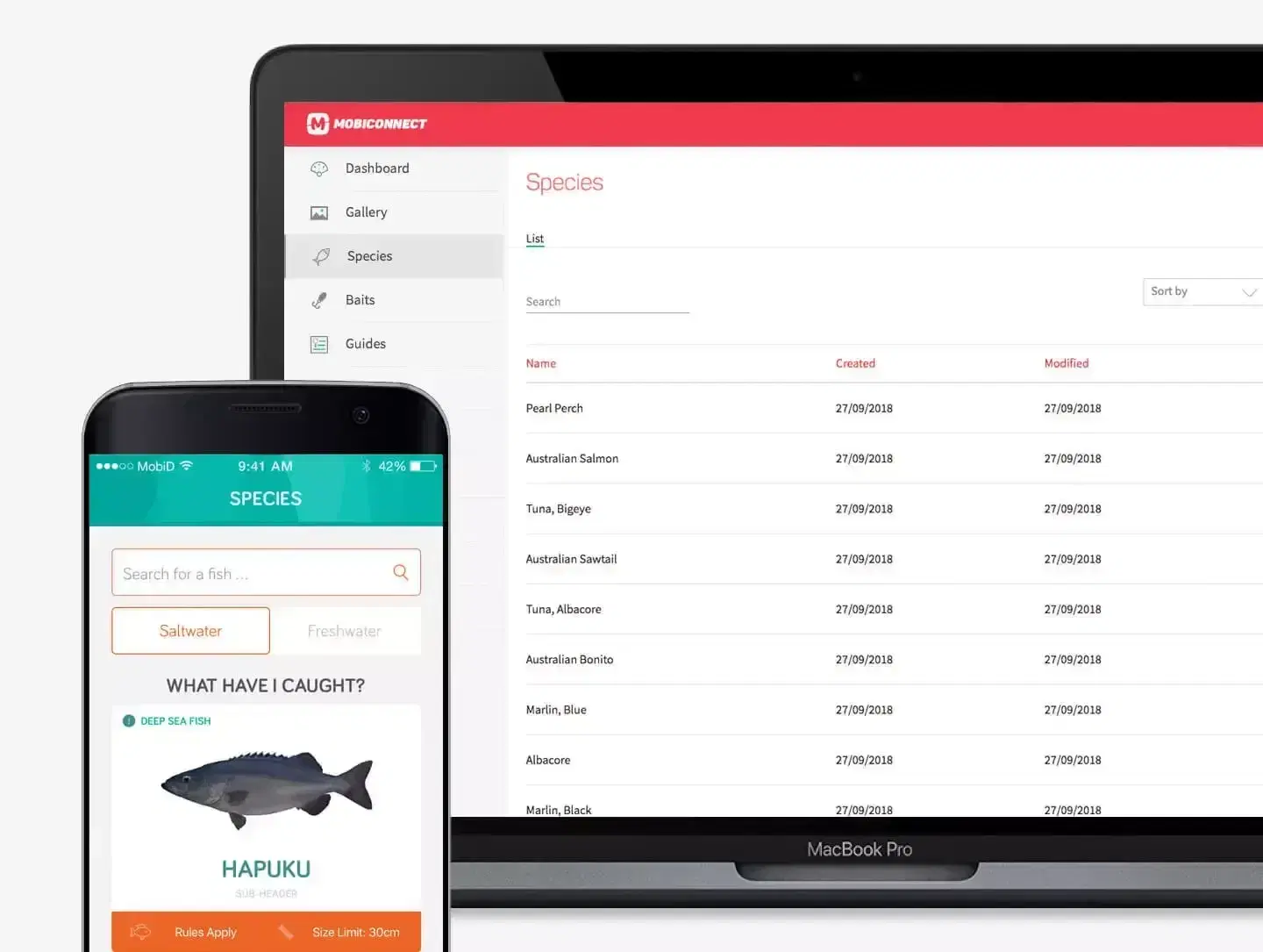
Authorised staff manage species, limits, news and alerts from a secure web console, with roles that set who can change what and an audit log of every change.
Delivered and Run by Us
A decade of releases with DPIRD Fisheries
FishSmart was originally delivered on Mobiconnect, Mobiddiction’s platform at the time. We have run it with DPIRD Fisheries ever since, with managed services, Australian cloud hosting and structured release cycles.
It is developed and operated under Mobiddiction’s Information Security Management System, certified to ISO/IEC 27001:2022 by an independent, accredited auditor.
FishSmart in depth
How FishSmart was designed and delivered, and the marine programs it sits alongside.
Project type: Government
FishSmart
The official NSW recreational fishing app: location-specific rules, bag and size limits and legislated fishing zones, available offline, with over 350,000 downloads since 2015.
Read case study
Project type: Government · Public safety
Marine Management
Beach alerts, shark detection and fisheries tools for NSW Government agencies. SharkSmart runs on M4. We have operated SharkSmart since 2014 and FishSmart since 2015.
Read case study
Tell us about your regulatory program
Rules, zones and updates the public can rely on. Tell us what yours needs and we’ll come back to you.